top of page

Commercial Drone Mapping, Media, Inspections and Documentation for Construction, Real Estate, Land Development and Engineering Projects
 

Drone Mapping & Photogrammetry - 3D Reality Capture & Digital Twins
Asset Intelligence & Inspection - Construction Progress Monitoring  
360-degree Walkthroughs - Commercial Real Estate Media Packages
Screenshot 2026-05-08 003014.png

For Land Development, Construction, and Infrastructure Projects

High-accuracy drone mapping and baseline documentation used for planning, progress tracking, and as-built records.

DJI_20260221141941_0009_V_edited_edited.

For Land Brokers, Investors, and Property Listings

Drone photography and videography, including boundary overlays and field notes, that help remote buyers understand property layout and potential.

-post-ai-image-21464.qhpeybyli5gwajjw-22jnjxcbrusjiv6d3gde5dqvuy.png

For Commercial Properties and Facilities

Detailed aerial inspections and 360-degree walkthroughs with clear visuals and annotated findings to support maintenance planning and risk reduction.

PRECISE, USABLE DATA

Centimeter-level presision mapping and inspection imagery designed for measurement, analysis, and reliable decision-making.

SUITED FOR COMPLEX SITES
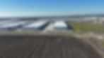
Experienced with large properties, multi-structure sites, and active environments. Correspond with the FAA and other authorities regarding airspace restrictions.

ACTIONABLE INSIGHTS

Clear visuals, annotated findings, and structured outputs that help clients identify issues and move forward quickly.

3D Modeling Point Cloud
New Construction Progress
New Construction Earthworks
Remote Land Listing
FAA Part 107 Compliant
New Construction Progress Update
Commercial Real Estate Listing
MEET THE FLEET: "Kermit" DJI Mini 4 Pro
MEET THE FLEET: "Oscar" DJI Mavic 3 Enterprise
bottom of page